


by admin
Welcome to the neighborhood planning process!
The Tarrytown Neighborhood, along with the Bryker Woods and Pemberton Heights Neighborhoods, are officially going through the City’s “Neighborhood Plan” process as part of the Central West Austin Combined Neighborhood Planning Area. The Neighborhood Planning Process will address a number of important issues,
including, Parks & the Environment, Transportation, Urban Design/Neighborhood Character, and Land Use & Zoning (properties may be rezoned as a result of the planning process).
Neighborhood planning is an opportunity for citizens to take a proactive role in the planning process and decide how their neighborhoods will move into the
future. All stakeholders of the neighborhood – business owners, renters, residents, property owners, and various community organizations and institutions — are invited to provide
community input addressing the local issues and concerns affecting the neighborhood. Working together with Neighborhood Planning staff, stakeholders establish a clear vision of their priorities, needs and guide for future development. For a general introduction
to neighborhood planning, visit our Overview of Neighborhood Planning.To browse other education and background materials, visit Neighborhood Planning
Library Resources. Finally, to see the previous West Austin Neighborhood Group “Neighborhood Plan” adopted in
1986, see the WANG Neighborhood Plan (www.WestAustinNG.com/neighborhoodplan.pdf).
Also, please check out the updated Website,www.ci.austin.tx.us/zoning/central_west_austin.htm for more information.
Previous
Meetings (Listed Chronologically)
Neighborhood
Plan Kickoff Meeting on June 21, 2007 | Agenda | Notice
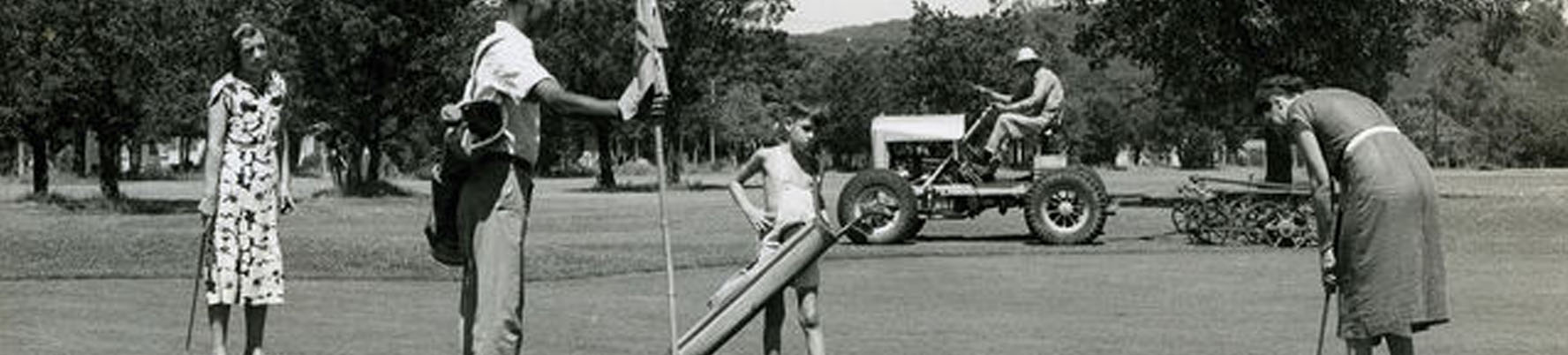
The Kickoff Meeting for the
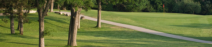
Central West Austin Neighborhood Plan was held on June 21 at the Lions
Municipal Golf Course Club House, and the turnout was tremendous! At the Kickoff Meeting, the City staff
presented various aerial and land use maps of our neighborhood, and provided an
introduction and overview of the neighborhood planning process.
Powerpoint
Presentation– Introduction to the Neighborhood Planning Effort
Stakeholder
Input–
See their responses about improving the neighborhood
Meeting
Game–
stakeholders were asked to perform several tasks to facilitate discussion
At the June 21 meeting, certain questions
were raised, and the following links provide information about those questions:
· In response to
questions about which neighborhoods have been through the neighborhood planning
process, see the neighborhood planning status map at http://www.ci.austin.tx.us/zoning/downloads/npstatus_tab.pdf.
· In response to
questions about the status of the Brackenridge Tract, see the document entitled
“The Brackenridge Tract: Frequently Asked Questions” which is posted at www.WestAustinNG.com/BrackTractFAQ.pdf. Additional information is posted at http://www.WestAustinNG.com/BrackTract.htm.
· In response to
requests to see a copy of the Brackenridge Tract Development Agreement, it is posted
at http://www.WestAustinNG.com/BrackenridgeAgreement.pdf.
First
Workshop, July 11, 2007 | Agenda | Notice
This
workshop focused on stakeholder issues, expectations and questions for the
planning area, and also allowed stakeholders to provide input discussing the
initial survey results and neighborhood history.
If you
could not attend this meeting, please fill out and return the What
issues you would like to discussquestionnaire.
· Initial Survey Results are in, with over 300
respondents! See what issues you and your fellow participants thought were
important by clicking
here.
Second Workshop, August 1, 2007 | Agenda | Notice
This
meeting focused on answering stakeholder questions and concerns about the
planning process
What
were stakeholders issues, expectations, and questions from the July 11 Meeting?
Mapping the
Neighborhood Vision, August 30, 2007 | Agenda | Notice
This
meeting focused on reviewing neighborhood demographic data and obtaining
stakeholder input using a neighborhood vision map exercise
Definition
of Vision, Goals, Objectives, and Recommendations
PowerPoint
Presentation(demographic data comparisons between 1990 and 2005)
Vision and Goals
Workshop, September 13, 2007 | Agenda
In this
meeting, stakeholders provided input to begin drafting various “vision” and
“goal” statements for the neighborhood plan
PowerPoint
Presentation(explains “Visions,” “Goals,” etc.)
Examples
of a Vision from other plans
Examples
of Goals from other plans
Results
from the August 30 Vision Mapping exercise (these were not presented
at the Sept 13 meeting, as suggested by the City’s website)
First Issue Specific Workshop –
Parks and Open Spaces, Thursday, September 27, 2007 | Agenda |
In this meeting, stakeholders provided
input on the topic of parks and open space issues. Presentations were made by the City’s Parks
and Recreation Department and the Keep Austin Beautiful program, and
stakeholders conducted a brainstorming session to propose ideas for maintaining
and improving parks, as well as creating additional park space and open areas
in any development of larger areas (e.g., Austin State School, Lions Municipal
Golf Course, Brackenridge Tract, etc.) as buffers to the existing residential
neighborhood. A copy of the PowerPoint
Presentation for the Parks and Open Space Workshop is posted at http://www.ci.austin.tx.us/zoning/downloads/cwa_PowerPoint_Sept_27.pdf.
The
City’s website includes a posting of Meeting
Notes for the meeting. These meeting notes do not correctly reflect what actually occurred at the meeting, particularly
with reference to the statement that the stakeholders approved the proposed
working goal. In fact, the stakeholders
requested a number of revisions to the proposed working goal to clarify that
the goal here should also include creating open space and parks on large
properties to serve as a buffer to protect existing single family homes in the
neighborhood.
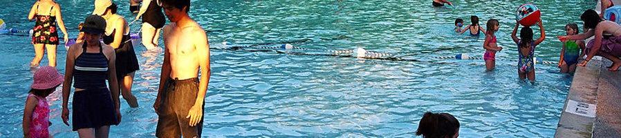
On the topic of “Parks and
Open Space,” please be sure to review the “Parks and Environment”
section from WANG’s 1986
Neighborhood Plan (www.WestAustinNG.com/neighborhoodplan.pdf.
Second Issue Specific Workshop –
Transportation, Wednesday,
October 17, 2007 | Agenda |
In the Traffic Issues Workshop meeting, stakeholders
received presentations from City Staff concerning traffic issues, such as
traffic calming, cut-through traffic, speeding, bike lanes, and sidewalks. In addition, there was a discussion of the
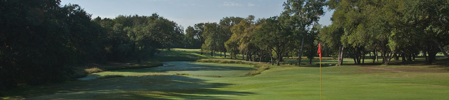
report by the Brackenridge Task Force concerning the redevelopment of 345 acres
along Lake Austin Boulevard and the Colorado River that includes 500 units of
affordable housing for married students (many with children), the municipal
golf course, a biological field lab, and the West Austin Youth
Association. In summary, the Report
recommends that a master plan be prepared to guide the development of the
entire tract by leasing (not selling) the tracts (including the Golf Course and
WAYA facility) to meet “pressing financial needs of the University.” The Board of Regents is holding a public
hearing on the report on November 9th at 1:30pm at 201 W. 7th Street. You can view the task force’s report at http://www.utsystem.edu/bor/files/bracktract/report.pdf.
Time ran out
before the group interaction exercises were conducted to review traffic circulation
and management, bikes, and sidewalks data.
On the topic
of “Transportation,” please consider the Transportation section from WANG’s 1986
Neighborhood Plan (www.WestAustinNG.com/neighborhoodplan.pdf.
Third Issue Specific Workshop –
MoPac and Mass Transit, Wednesday, November 14, 2007 | Agenda | Meeting
Notes
Focus: Stakeholders
provided input on draft Parks goal.
Presentation from the
Texas Department of Transportation, Capital Metropolitan Transportation
Authority, and the Austin/San Antonio Intermunicipal Commuter Rail District
regarding
Loop 1 (MoPac) and mass
transit. Stakeholders asked questions
about MoPac sound barriers, traffic improvement, managed lanes and other
transportation project implications.
Documents: PowerPoint
presentations from the Central
West Austin planning team (including TxDOT Loop 1/MoPac presentation), Austin-San
Antonio Intermunicipal Commuter Rail District, and Capital
Metro.
A second Capital Metro presentation, about their long- and short-range planning
efforts, was not given during this meeting, but can be viewed here: Capital
Metro Long and Short Range Planning.
Fourth Issue Specific Workshop –
More Transportation, Wednesday, December 5, 2007 | Agenda | Meeting
Notes
Focus: Stakeholders revised the draft Transportation Goal as follows:
Transportation Draft Goal
“Support and not
compromise the livability and vitality of Central West Austin neighborhood
streets by not widening existing streets, enhancing safety and convenience for
pedestrians, cyclists and transit users (with particular attention to routes
serving neighborhood schools, parks, and libraries), improving access to
reliable transportation services, enforcing speed limits, controlling on-street
parking to protect residents’ property rights, and maintaining acceptable
traffic service levels and traffic safety and protecting against cut-thru
traffic.”
In addition, the stakeholders worked
in groups for a mapping exercise to revise and extend transportation issues and
concerns in the neighborhood. In particular, topics discussed included
proposed transit oriented development at the MoPac/35th street
intersection, designing traffic flow to address future development at
Brackenridge, Camp Mabry and the Austin State School, sidewalks, school bus
routes through the neighborhood, cut-through traffic, traffic calming,
speeding, and bike lanes.
Documents: PowerPoint
presentation | Concerns
and opportunitiesregarding
a potential commuter rail station at 35th St. | Transportation
Goal handout.
Maps: Two maps were handed out at this
meeting, including the Traffic
count map (explanation
of map; traffic
count data) and Traffic
collision map (explanation
of map).
Fifth Issue Specific Workshop –
Process Check-up & Vision, Wednesday, January 9, 2008 | Agenda
and Plan Timeline |
Focus: Review what was covered in 2007, and what will be done in 2008—trees,
creek erosion, neighborhood character, housing, land use, and zoning. In addition, draft recommendations for the
parks and open space chapter were introduced, and a vision statement was “workshopped.” On both topics (see “handouts”
below), comments may be provided by contacting Greg Claxton at gregory.claxton@ci.austin.tx.us.
Documents: Powerpoint
presentation | draft
Vision handout | Parks and
Open Space handout
Sixth Issue Specific
Workshop – Trees, Wednesday, January 30, 2008 | Agenda |
Focus:
Presentation by City Staff regarding Austin’s tree protection and planting
programs and how Austin Energy manages trees alongside its utility
infrastructure. Neighbors were asked to prepare for the meeting by
thinking about the questions posted at http://www.ci.austin.tx.us/zoning/downloads/CWA_Jan9_HWJan30.pdf.
Topics addressed included the different roles that trees can play in shaping
neighborhood character, providing shade for pedestrians, lowering energy costs,
and improving creek erosion.
Documents: Neighborhood
planning staff presentation | Austin
Energy presentation | Tree
protection regulations presentation. For more
information, please see the City’s information on urban forestry and Austin Energy’s tree
trimming website.
Seventh Issue Specific
Workshop – Water, Creeks, Erosion & Flooding, Wednesday, February
20, 2008 | Agenda | Mapping
Exercise handout
Focus: Watershed Protection
and Development Review staff presented information about water quality and
drainage issues. A mapping exercise looked at flooding and erosion
problems and opportunities for water quality improvement.
Documents: Watershed
Protection Presentation Entitled “Protecting Lives, Property and the
Environment”; part two.
Eighth Issue Specific Workshop –
Community Life and Housing Affordability,
Wednesday, March 5, 2008 | Agenda |
Focus: Neighborhood crime and safety
presentation from APD Sergeant Dustin Lee, followed by a presentation of staff
discussions with the principals of Brykerwoods Elementary, Casis Elementary,
and O. Henry Middle Schools. We ran long
and did not get to the housing affordability section. Before the meeting, the vision statements (below) were presented and attendees voted for their favorites.
Documents: Planning
staff presentation | APD presentation |
Crime maps: personal, property, nuisance, drug/alcohol | Crime
tallies by offense | APD
Districts for Central West Austin
Links: Sergeant Lee mentioned two
online safety resources the city provides. First is the Resource Manual, which
directs citizens to city resources for complaints or problems. Second is APD’s
online crime map viewer.
Ninth Issue Specific Workshop – Residential Review, Code
Enforcement, Housing Affordability, and Historic Preservation, Saturday, March 29,
2008 | Agenda | Presentations: part 1, part
2 |
Focus: Jessica King from Residential
Review talks about the city’s review of new construction, demolitions, and
remodels and how to report violations. Susan Villareal from historic preservation talked about historic
designations and historic districts. Paul Tomasovic of Code Enforcement talked about how to spot and report
code violations. The group did a mapping exercise to look at what areas could
be designated historic and what characteristics of housing in the neighborhood
they wanted to preserve.
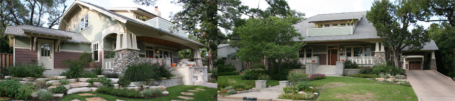
On the
topic of affordable housing, there will likely be a request made for locating
multi-family zoning in our neighborhood. On this topic, please be sure to review objective 1.6 of the “Land Use”
section from WANG’s 1986 Neighborhood Plan (posted at http://www.WestAustinNG.com/neighborhoodplan.pdf), which is set forth below:
1.6 Limit multifamily housing as a buffer from office and retail
zoning along arterials. It should not be
permitted as an end in itself. A buffer
is a use which is less intrusive than that which is being buffered.
Tenth Issue Specific Workshop – Mid-Process Review And Open
House, Saturday, April 26,
2008 | Agenda | Introductory
presentation | Chapter drafts (Word) (PDF) |
Focus:
At this meeting, staff and stakeholders discussed the following draft
neighborhood plan chapters:
· Transportation
(available as PDF; editable
Word file).
· Parks,
Open Space & Environment (available as PDF).
· Community
Life (not available).
· Neighborhood
In Context (not available).
Stakeholders reviewed the draft chapters to
determine whether they help to create the neighborhood that we envision for the
future. Neighborhood stakeholders have
been working on revisions to the draft “Transportation” and “Parks” chapters,
which are posted as redlined documents at “Revised
Transportation Chapter” and “Revised
Parks Chapter.”
This WILL NOT be the final review for these
chapters, and staff
will continue to take comments on these chapters in the coming months.
Eleventh Issue Specific Workshop
– Land Use Education Workshop, Wednesday, May 7, 2008 | Presentation | | Current
Land Uses Maps: WANG, Windsor
Road.
This
meeting introduced the first step in the land use planning process, and set the
foundation for the upcoming land use meetings.
Twelfth Issue Specific Workshop – First Land Use Workshop, Wednesday, May 21, 2008, LCRA Red
Bud Facility | Agenda
Staff
reported on their first meeting with the Brackenridge Tract consultants, which
included a tour of Lions Golf Course. The consultants, led by David McGregor,
of Cooper Robertson, attended part of the meeting, and introduced themselves.
Staff also announced the formation of a transportation sub-committee to discuss
in more detail some of the problems that came up during the April 26
Mid-Process Review.
Staff
talked about land use patterns within Central West Austin, as well as the
context the neighborhood is in within the city as a whole, and introduced the
framework of corridors and nodes that will be used to break the neighborhood
into manageable pieces for future land use meetings (see the corridor and node map and schedule.
There was
a discussion of “things to protect and preserve” and “things to
change or enhance;” see the results in this photo of the meeting’s white
board.
Finally, the group began putting colors on the map: some civic uses (public
schools, fire, and EMS) and parks and open spaces.
Second Land Use Workshop, Thursday, June 12, 2008, LCRA Red
Bud Facility
This workshop discussed land uses along Exposition
from Casis Elementary to Windsor Road as well as Windsor Road from Exposition
to MoPac. Three separate groups
attempted to map out future land uses for these areas, but none of the groups
completed the exercise.
Third
Land Use Meeting, Thursday, June 26, LCRA Board Room.
The workshop was
a continuation of the “Land Use” workshop which continued with mapping the future land use along Windsor and
Exposition.
Brackenridge Workshop, Saturday, July 12. LCRA Red Bud Facility | Agenda
Staff
presented an overview of the Brackenridge Tract and its development agreement.
A researcher at the Biological Field Lab gave a presentation on what the Field Lab
does. Stakeholders were asked what the pros and cons were of the current uses
on the Brackenridge Tract, and what their preferences were for the Tract in the
future.
Documents:
Presentations: by City
staff, by
the Biological Field Lab| Stakeholder
responses| Helpful
information| For more information on the Brackenridge Tract,
click here.
Fifth Land Use Meeting, Wednesday, July 23, 6:30pm
to 9pm | Agenda
The three
land use groups continued their work on identifying future land uses for Exposition
Blvd and Windsor Rd.
Sixth Land Use Meeting, Saturday, August 2, 9am to 1pm,
LCRA Red Bud Center.
Topic: Continuation
of the discussion of Exposition Boulevard from Westover to Windsor, and Windsor
Road from Exposition to MoPac.
Seventh Land Use Meeting,
Wednesday, August 27, 6:30pm to 9pm,
LCRA Red Bud Center.
This workshop discussed land uses along Exposition (from Windsor Road to Enfield)
and Enfield (from Exposition to MoPac). To move away from the “consensus” approach for making decisions only
with unanimous agreement, the City Staff introduced a new two-stage framework
for land use meetings. In the first
stage, stakeholders met in separate groups to discuss what is good about these
corridors and what is wanted in the future for these corridors. Subsequently, City Staff will present the
Future Land Use categories that would achieve the different ideas that
stakeholders discussed in the first meeting. Stakeholders will then select an option to put in the plan.
At the
meeting, Staff presented this
handoutfor context on these two roads. Subsequent to the meeting, the results of the
brainstorm were posted here.
w:st=”on”>
Eighth
Land Use Meeting, Thursday, Sept. 11, 6:30pm to 9pm
At our
last meeting, it was overwhelmingly decided to maintain the current “single
family” land use patterns for Exposition (between
Windsor
and
Enfield) and the “multi-family” land use
pattern for the intersection of Exposition and
w:st=”on”>
Enfield. The results are posted here.
Documents: Land
use options | Results
for Exposition and the intersection of Exposition and Enfield|
Stakeholder comments from
August 27 | Corridor handout from
August 27 Land Use meeting.
w:st=”on”>
Ninth
Land Use Meeting, Sept. 24, 6:30pm to 9pm, LCRA Hancock Building Board Room.
At this meeting, the stakeholders determined the future
land use map for two areas on
Enfield
Rd. between Exposition and MoPac, voting by
consensus to keep Enfield Road (Between Exposition and Mopac) at its current
mix of Multifamily and Single Family, and to keep the intersection of Enfield
and Mopac (on the west side) at its current mix of Multifamily and Single
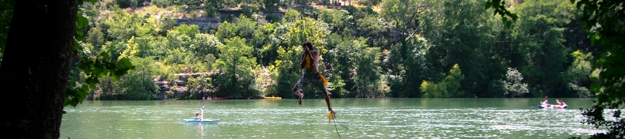
Family. There was also a “brainstorming” discussion of how the Deep Eddy
section of
Lake Austin Blvd
(from MoPac to Hearn) is currently used and how it could better serve the
neighborhood in the future.
Documents: Agenda | Corridor
handout for Deep Eddy along Lake Austin Blvd| Sept
24 results
Tenth
Land Use Meeting, Oct. 8, LCRA Red Bud Facility.
At this
meeting, the stakeholders determined the future land use map for Deep Eddy
along
Lake Austin Boulevard,
voting by consensus to keep the current neighborhood commercial land use for
Area 1, and to keep the two parcels in Area 2 as single family.
Documents: Agenda | Results
w:st=”on”>
Eleventh
Land Use Meeting, Oct. 22, 6:30pm to 9pm, LCRA Red
Bud Facility.
At this
meeting, stakeholders discussed the non-single family areas east of MoPac: along
35th St
and
34th St,
and between
38th St
and
31st St
and Shoal Creek and
Lamar Blvd
(see the map here).
Documents: Agenda | Corridor
handout
Maps (these are large
files stored on our ftp site)
Aerial
Photo Maps: 2006 | 1997 | 1940
Traffic
count map (explanation
of map; traffic
count data)
Traffic
collision map (explanation
of map).
Documents
Initial
Population Data Summary
Council
Resolution authorizing the Central West Austin Neighborhood Planning Initiative
Building
Permit Data, 1990-2007
West
Austin Neighborhood Group Demographics
Austin
Police Department Area Statistics
City Staff Planning Team Contact
Information
Paul DiGiuseppe
paul.digiuseppe@ci.austin.tx.us
(512) 974-2865
Adrienne Domas
adrienne.domas@ci.austin.tx.us
(512) 974-6355
Victoria Craig
victoria.craig@ci.austin.tx.us
(512) 974-2857
Greg Claxton
gregory.claxton@ci.austin.tx.us
(512) 974-7630
The Central West Austin Neighborhood Plan Contact Team will hold its Annual Meeting on Monday, April 21, 2025 (6pm) at Howson Branch Library. The meeting agenda is set forth below: I. Call to Order A. Officer Election. Our current officers are Mike Cannatti (Chair), August Harris (Vice Chair), and Joyce Basciano (Secretary). Mike is stepping […]
-
PURPOSE OF MEETING: The City of Austin is sponsoring this community meeting to provide an opportunity for the applicant, neighborhood planning contact team, nearby residents/property owners and any other interested parties to discuss the proposed plan amendment and zoning change requests: Property addresses: 2614, 2614 1/2 Exposition Blvd and 2702 McCullough St. (4.64 acres) Plan […]
Call to Action — Request Bond Funds to Protect Neighborhood: Help protect the ‘hood by attending this Thursday’s Bond Election Advisory Task Force Meeting (Thursday, Jan. 4, 4pm at City Hall) and telling them to include funding in the 2018 Bond Package to purchase strategic properties as they become available, such as Lions Municipal Golf […]