


by admin
QUICK LINKS TO
PROTECTION STRATEGIES:
DEMOLITION PROTECTION STRATEGIES
REVIEW DEMOLITION PERMITS ON CITY WEB SITE
BY STREET ADDRESS: To find out if a demolition permit has been granted
for a property, you can search for Building Plans which are filed with the
City’s building inspectors before construction or demolition activity
occurs. You can also search for Permits
which are granted and updated by the City’s building inspectors as the
construction or demolition activity occurs.
To find demolition permits and
plans, you can search the City’s web site (http://www.ci.austin.tx.us/development/pierivr.htm)
by property address. Unfortunately, you
need to search for demolition permits at both the Permit Search site (http://www.ci.austin.tx.us/pierivr/permit_menu.cfm)
and the Building Plan search site (http://www.ci.austin.tx.us/pierivr/building_plan_menu.cfm)
by entering the street address of the property in question. The search results from the Permit Search
site will list “DEMO” in the description field for any demolition permits,
while search results from the Building Plan search site will usually include a “D” at the end of the
BP Number for any demolition permits.
PREVENT DEMOLITION OF HISTORIC PROPERTIES
BY CONTACTING HISTORIC LANDMARK COMMISSION: Currently, the City
Historic Preservation Office and the Historic Landmark Commission review
applications for demolition or relocation permits to determine whether a
building meets the criteria for designation as a historic landmark. The determination is made according to
objective criteria, but designed to protect those buildings with exceptional
significance to the city because of their architecture and historical
associations.
To determine if a property meets the criteria for
historic designation, see the City
of Austin Historic Landmark Designation Criteria by
clicking here. Generally speaking,
the property must at least (1) be 50 years old, (2) retain sufficient integrity
to convey its historic appearance and (3) be significant in at least two of the
following categories: architecture,
historical association, archeology, community value, or landscape feature. If you believe that a property meets the
criteria for designation as a historic landmark, please contact Steve Sadowsky,
Historic Preservation Office (974-6454 or steve.sadowsky@ci.austin.tx.us) with your concerns, and be sure to document all
communications you have.
APPLY FOR LOCAL HISTORIC DISTRICT
PROTECTION:
In December 2004, the Austin City Council passed an amendment
making a number of changes to the historic preservation ordinances, including
allowing for the establishment of local historic districts by providing
rehabilitation incentives for properties in such districts. The City Historic Preservation Office is
developing nomination forms and other materials necessary for the
implementation of the historic districts. A summary
of the new ordinance that was sent out to landmark owners may be obtained
by clicking here. Another summary from the City of Austin Preservation
Officer, entitled “LOCAL HISTORIC DISTRICTS IN AUSTIN,” may be obtained by
clicking here. THIS
IS BIG NEWS BECAUSE THE ORDINANCE MAY BE AN EXTREMELY USEFUL TOOL FOR OUR NEIGHBORHOOD.
According to the summary, tax abatements would be available
for qualifying improvements or rehabilitations. In addition, design standards for new construction within the district would
be provided to establish parameters for the design of new construction and to
provide neighbors within the district a higher level of comfort knowing that
new construction will be required to follow accepted design standards based
upon the existing architecture within the district. The district design standards will be
individually tailored to meet the needs of the particular district, and may
address building materials, height limits, and setbacks for new construction
within the district.
APPLY FOR NATIONAL HISTORIC DISTRICT
PROTECTION
The
National Register of Historic Places is the nation’s official list of historic
properties worthy of preservation. Listing in the register is an honor and carries no direct restrictions. A common misconception is that houses in an
historic district cannot be remodeled or demolished. This is not correct. Under Federal law, owners of private property
listed in the National Register are free to maintain, manage, or dispose of their
property as they choose provided that there is no Federal involvement. Owners have no obligation to open their
properties to the public, to restore them or even to maintain them, if they
choose not to do so.
Benefits
of registration include:
· Recognition for
historic importance of the Deep Eddy Heights area to our community,
· Increased property
values (think of increased personal wealth),
· Additional protection
from federal activities (think of MoPac),
· Eligibility for tax
credits of 20 percent for the approved rehabilitation of income producing
properties (including duplexes, apartments and dwellings converted to office
uses) (think of renovating Deep Eddy Pool or Cabaret),
· Qualification for
Federal grants for historic preservation, when funds are available.
Potential
drawbacks include the possibility that the City’s Historic Landmark Commission
might consider a listing on the National Register historic commission as part
of its determination of whether to deny a demolition permit. However, it appears that the Historic
Landmark Commission is no longer following this policy.
Additional
details about the qualification requirements and application process is
available at www.cr.nps.gov/nr/index.htm and at www.WestAustinNG.com/Deep%20Eddy%20Presentation.pdf,
which is a summary of information collected regarding an earlier investigation
of pursuing historic district protection for the Deep Eddy Heights area.
USE DEED RESTRICTIONS TO PROTECT NEIGHBORHOOD: At our May 2005
board meeting, Nikelle
Meade, a partner with the Brown McCarroll law firm, presented information
on how deed restrictions can be used as an effective tool for like-minded
neighbors to protect their local neighborhood from over development. A summary of the presentation, entitled
“Restrictive Covenants” is available by clicking here.
WANG will work toward setting up a
program to help small groups of neighbors (perhaps a group of neighbors on a
one or two street area) enact an agreed set of deed restrictions that would
preserve the general "look and feel" of the street, or at least
prevent the most offensive development outcomes.
CONSTRUCTION PROTECTION STRATEGIES
Zoning and Building Code Restrictions: Zoning districts
were established to promote compatible land use within the City limits and to
control development density. Zoning
districts typically set restrictions on building height, bulk layout,
impervious cover, fence height, etc. SF-3 “Family Residence” is the predominant zoning district for West
Austin, though there are also some commercial properties along Exposition and
Lake Austin Boulevard.
As a property owner, you are ENTITLED to the land
uses that are defined by the zoning for your property. From a historical perspective, the
restrictions on land use provided in the zoning districts (such as impervious
cover) were intended to be an absolute upper bound on property use, and were
never intended to define an sort of “average” use definition. So when you purchase an SF-3 zoned property,
you have the right to make the following uses of your property:
You can build a single family house (or
a duplex if the lot is 7000 sq. ft) that can be positioned on the property up
to the minimum setback distances from your property lines (front yard setback
of 25′, street side yard setback of 15′, interior side yard setback of 5′, and rear
yard setback of 10′). Under coverage
limits, the building can cover up to 40% of the property, and the total
impervious coverage can be up to 45% of the property. If you build any fences on the property line,
the fence may be 6′ in average height, but may be a maximum of eight feet in
height if the fence is located on or within the building setback lines.
According to the Residential Design
& Compatibility Standards (the “McMansion Ordinance”), there is a “floor-to-area
ratio” limit on the size of the home to the greater of 2,300 square feet or a
square footage that is 40 percent of the lot size, though certain features (such
as attics, small attached garages, detached rear garages and first-floor
porches) are not counted toward the size because these elements do not add to
the mass and bulk homes. A setback
building envelope was also added to push height away from adjacent neighbors,
allowing traditional two story homes (e.g., up to 20 feet tall) to be built at
the five foot setback line, but requiring taller structures to be moved away
from the adjacent neighbors. In
addition, a height limit of 32 feet applies for single family homes (30 ft. for
duplexes), and side wall articulation requirement was added for certain
sidewalls over 32 feet in length and 15 feet in height. The “McMansion Ordinance” addresses concerns
about overly large new houses that loom over existing neighbors and destroy
neighborhood character, but that would still allow homeowners to build bigger
and taller homes.
There are also certain permitted
uses for an SF-3 zoned property. For
example, authorized residential uses for SF-3 zoning include Single-family
Residential, Lodging-house Residential (Owner occupied B&B) and Retirement
Housing (small site). Civic uses for
SF-3 zoning include Communication Service Facility, Day Care Services
(limited), Group Home, Class I (General), School and Religious Assembly.
To see a summary of the zoning requirements for
SF-3 residential properties (which is the zoning category that applies to most
of the WANG area), see the “Zoning 101”
summary and the City’s
Site Development Standards for Residential Zoning.
In addition, the 2001
Neighborhood Planning Guide to Zoning is a
handy reference guide that lists all zoning codes (e.g. SF-1, MF-4) and their
specifications, such maximum building height, minimum lot size, and allowed
uses. Also included are descriptions of allowed civic, commercial,
industrial, and residential uses. The first section of the guide lists the
Smart Growth infill and redevelopment options under the Neighborhood Plan
Combining District.
Private Deed Restrictions and Restrictive
Covenants: In addition to use
limitations provide by zoning laws, deed restrictions and/or restrictive
covenants may also limit use of a property. For example, the deed restrictions for a property may impose a front
yard setback requirement that is more restrictive than the city’s
requirement. Very often, a property
record search must be made in order to locate such restrictions/covenants, but
they can be a powerful tool for preserving property values and neighborhood
standards.
Deed restrictions are considered “private” matters
and are not enforced by the City. Normally deed restrictions deal with the character of the neighborhood
and can be enforced by neighborhood associations or private citizens in civil
court.
REVIEW BUILDING PLANS FOR NEW CONSTRUCTION: Residential permit
applications for a property usually include a description of the project
(square footage, impervious cover, etc.) and a topographical survey with the
outlines of the structure to be built. To see the applications filed by the builder with the City, you can
search the Building Plans web site (http://www.ci.austin.tx.us/pierivr/building_plan_menu.cfm)
by property address. The search results
from the Building Plan search site will usually include a link (labeled “APPLICATION”) to the application under the “DOCUMENT
INFORMATION” heading, though the documents are downloaded as TIF files that
sometimes are blocked by pop-up blockers on your browser, so you may need to
jiggle your browser settings.
CONTACT PROPERTY OWNER/BUILDER ABOUT BUILDING PLANS: Neighbors
who live near a new home or remodel project will very often want any project to
be compatible with the existing “look and feel” of the street, and may also
have helpful information for the new owner regarding easements, private deed
restrictions, water flow concerns, etc. All concerned parties can benefit by meeting early in the construction
process about a project. To contact a
new property owner, try reaching the owner or builder identified at the
property site, or look up the owner on the Travis Central Appraisal District web site by performing a property address search at http://www.traviscad.org/travissearch.php?mode=situs&kind=real.
CONTACT CITY BUILDING INSPECTOR ABOUT CODE VIOLATIONS OR
ENFORCEMENT CONCERNS: If you are concerned that the City is not
enforcing its land use and zoning requirements relating to impervious cover,
setback requirements, tree protection, you can contact your neighborhood
association by clicking here, but you should also contact the City code enforcement
directly at Zoning.Enforcement@ci.austin.tx.us or 974-6576. You should be prepared to provide a specific property address and to
specify your concern. Violations can be
reported anonymously. The City will
follow up a zoning violation with a verbal notice. If no action taken, a written notice will be
sent. Finally, a court date will be set
if no action is taken. A court can fine
up to $2000/day for noncompliance.
CHALLENGING ZONING CHANGES AND VARIANCE
REQUESTS: Property owners are required to comply with the current
zoning rules if they wish to expand and/or improve their property. If a property owner wishes to exceed the
allowed zoning uses or requirements, he or she must obtain a “variance” or
zoning change before making any changes on the property. A property owner wishing to have an exception
from the current zoning restrictions can file a variance request with the
City. One needs to go before the Board
of Adjustment for a zoning variance, at which point neighborhood input is
permitted, as described below. No
construction is permitted until a variance is granted and/or an appeal is
completed. To see the Board of
Adjustment rules and regulations, click here.
Prior to the Board of Adjustment
hearing (described above), notices of the variance request are sent to
residents within 300′ of the property and to any organization having an
interest in the application (such as a neighborhood organization). If an affected resident or neighborhood
organization objects to the variance request, that objection should be
presented at the Board of Adjustment hearing. Objections may be presented by filing out the objection form provided
with the notice and delivering it to the Board.
Either party may appeal a variance
decision by the Board of Adjustments. An
appeal must be filed within 14 days, and can only be filed by the property
owner in question, property owners within 500′ of the property or an officer of
affected environmental or neighborhood organization.
In addition, a “petition” procedure requires a
super majority of the City Council to approve a zoning change. Instructions on how to file a valid
petition to protest a proposed zoning change are available by clicking here. Under this procedure, neighbors within a 200′
radius of the property in question who protest a zoning change can file a
“petition” with the City Council. If a
written protest against a proposed rezoning, signed by 20% or more of either
the area of the lots or land included in such proposed change, or of the lots
or land immediately adjoining the same and extending 200 feet therefrom, such
rezoning shall not become effective except by the favorable vote of
three-fourths of all members of the Council.
For more detailed information, see
the “Zoning 101 presentation handouts” on the Austin Neighborhoods Council web
site at www.ancweb.org/docs/Zoning%20101%20Handout.pdf.
The Camp Mabry track will be closed for renovations starting June 23, 2014. The track is schedule to re-open in August, weather permitting. Please click on the following documented for more information: 2014.06.09 Camp Mabry Track Revamp Press Release
On April 17, 2014, the City Council will consider proposed code amendments creating a Lake Austin (LA) District District overlay extending environmental protections from the existing LA base zoning district to properties within 1,000 feet of Lake Austin. Details on the proposed ordinance are posted at http://austintexas.gov/department/lake-austin-development-code-revisions, and relate to boat dock registration, boat dock […]
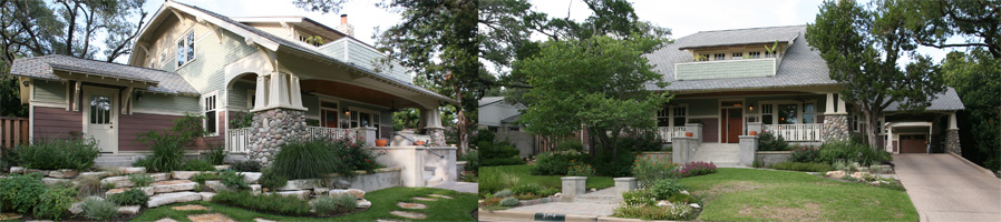
Across the nation and throughout our neighborhood, there are growing concerns that teardown trends are irreparably changing historic neighborhoods as fine historic homes are demolished to make way for much larger, new houses. Too often, these oversized structures disrupt the architectural and historic character of the existing neighborhood, diminishing livability and destroying the amenities that […]
The City of Austin Construction Awareness Information System is available to provide information about on-going construction projects that may affect your travel through the City. At the City’s web site: www.cityofaustin.org/ca, click on the map to get project information and the latest news and meeting dates. You can obtain construction information about Central Austin Projects […]